
The only access to St. Regis was I-90. I might have mentioned before that you can ride on I-90 in many of the western states because of the lack of other roads. Taking frontage roads doesn't normally change the scenery and the drivers, although fewer, have less road to work with. However, I'm always looking for alternate routes.
The leg to St. Regis was 14 miles. About five miles out, the road builder decided to put narrow rumbles across the entire shoulder about every 30 feet. This lasted for about four miles when the shoulder changed to moderately loose chipseal. I preferred the narrow rumbles.
St. Regis is just another one block town providing gas, food and lodging for travelers, however this time it also had an antique store. Rosie's alternate route found no treasures, but they did sell good beef jerky.
From St. Regis we took Rt. 135 along the Clark Fork River and through Lo Lo National Forest, AKA The St. Regis Paradise By-Way, nestled in the Bitterroot Mtns. This was the most scenic day of our trip to date. We had one brief delay when plagued by yet another flat. We've noticed more glass on the shoulders in this part of the state.
Route 135 took us to Rt. 200. When we turned onto that road the winds seemed to hit us from all directions.
The route travels between two mountain ranges. As we crossed over the river to get to Paradise we saw a large eagles nest, including chicks, on top of a train trestle. We ended our day in Plains at the Dew Duck Inn, probably the best little motel in MT.
Friday, August 20 we continued on Rt. 200 to Noxon. The road is bordered by the Coeur d'Alene Mtns., part of the Bitterroot Range and the Cabinet Mtns. We had little wind in either direction and a comfortable 62 mile day. With respect to our accommodations, we stayed at the Noxon Motel. Our first indication that this nine room gem was on the rough side was that there were weeds growing up around a car parked in front of one of the rooms. Guess we could have tented along the road, but that's becoming a tougher option. The room was small and lacked AC, although it did have a window fan. After I secured the fan on the sill with a length of rope tied off the curtain rod, so we could rotate it to regulate the flow of air, we were set for the evening. We did have great sirloin steaks at the Rusty Beaver, only a half mile walk from the motel.
Saturday, August 21 we crossed into Idaho on Rt. 200 heading for Sandpoint. En route Rosie thought she saw a Black Bear in the bush next to the road, at least it was black and hairy. We actually did see Big Horn Sheep grazing next to the road. We stopped in Clark Forks for our morning lunch. We had gained an hour, riding into Pacific Time. As we were leaving town we saw a group of bikers. Stopped to chat and learned they were from Pittsburgh, PA on a week long supported tour. The tour operator said the all inclusive tour costs $1,400.00, including middle shelf wine and speed rack whiskey. They were staying in resorts, not Noxon Motels. Rosie and I both got the impression many wanted to but didn't have the time to do a self-contained tour. We ended our day in Sandpoint, a 50 mile ride.
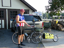
Sunday, August 22 we were on the road early having a 71 mile day ahead of us. Our destination was Chewelah, WA. We took Rt. 2 along the Pend Oreille River. Had some tailwind and enough downhill to quicken our pace. Rosie let me know she preferred a 15 over 18 mph pace. In any event, we made it to Newport, WA, 30 miles, in short enough order. From there we headed north on Rt. 20. Had to climb about a mile out of Newport, but the next 14 miles was a gift. We stopped at a restaurant just outside of Usk. A happy go lucky guy saw my camera around mt neck and offered to take our picture. As you can see, we were still in fine spirits after the first 45 miles..


No comments:
Post a Comment